Uploads by JenniferFindlay1
Jump to navigation
Jump to search
This special page shows all uploaded files.
| Date | Name | Thumbnail | Size | Description | Versions |
|---|---|---|---|---|---|
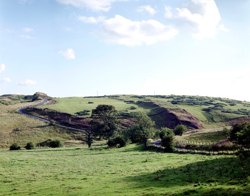
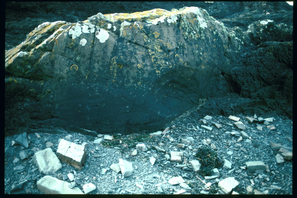
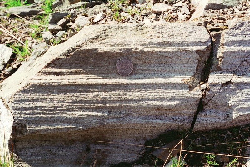
| 10:39, 26 January 2016 | P001208.jpg (file) |  |
129 KB | 400 m. north of The Knock. West Lothian. Looking south. Near Cairnpapple. Quartz-dolerite intruded into the Bathgate Hill Volcanic Formation. The quartz-dolerite is a steeply-inclined, transgressive part of the Midland Valley Sill, here orientated appr... | 1 |
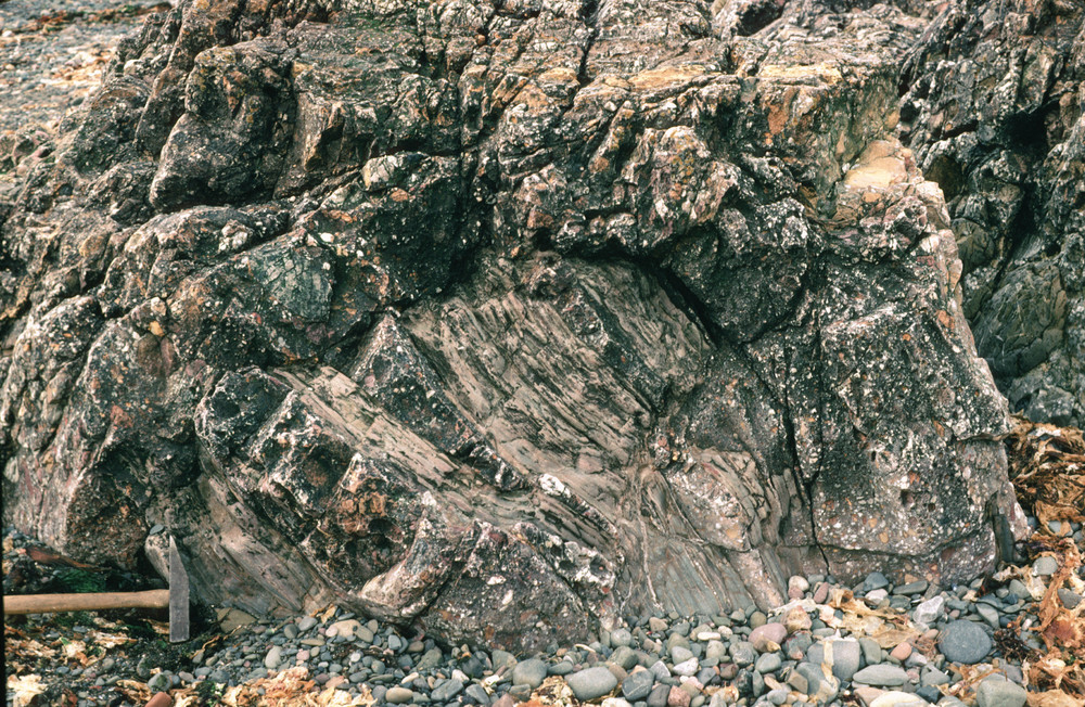
| 14:39, 9 December 2015 | P005981.jpg (file) |  |
384 KB | Horse Rock, by ruins of the Haven Hotel, 1 km. S. of Girvan. Craigskelly conglomerate (Silurian) with interbedded channel-form turbiditic beds. | 2 |
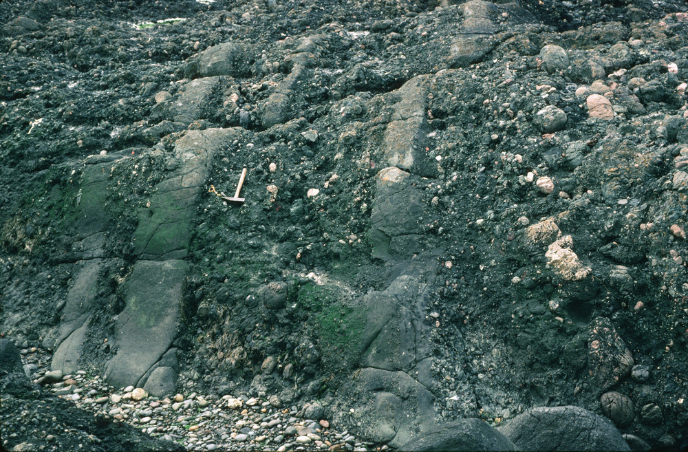
| 14:29, 9 December 2015 | P005980.jpg (file) |  |
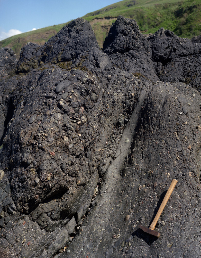
418 KB | Cow Rock, by ruins of the Haven Hotel, 1 km. S. of Girvan. Quartz-conglomerate (Silurian) channelled into slumped, laminate mudstones. Here seen disrupted and injected by the conglomerate. | 1 |
| 14:23, 9 December 2015 | P556403.jpg (file) |  |
133 KB | Ardwell Farm Formation, Kennedy's Pass, Girvan. Folding (thought to be sedimentary - slump induced?) in flaggy sandstone/siltstone. | 1 |
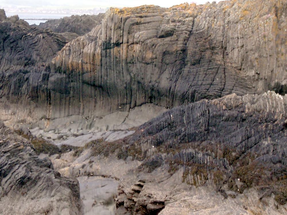
| 14:20, 9 December 2015 | P220329.jpg (file) |  |
402 KB | Kennedy's Pass, coast SW from Girvan. The Kilranny Conglomerate. Note inclined bedding defined by pebble imbrication. Late Ordovician. | 1 |
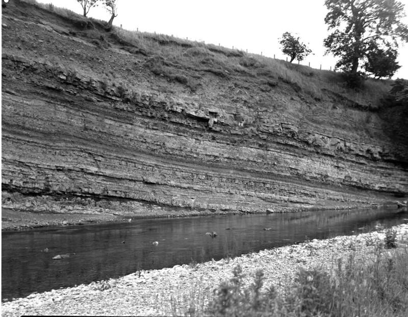
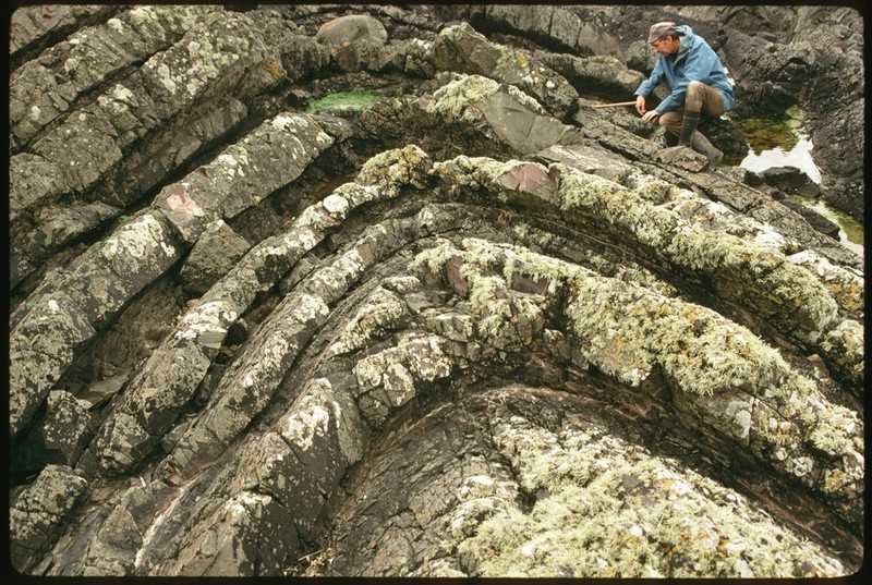
| 13:51, 9 December 2015 | P259025.jpg (file) |  |
234 KB | Ringdoo Point. F1 syncline. P259025 | 1 |
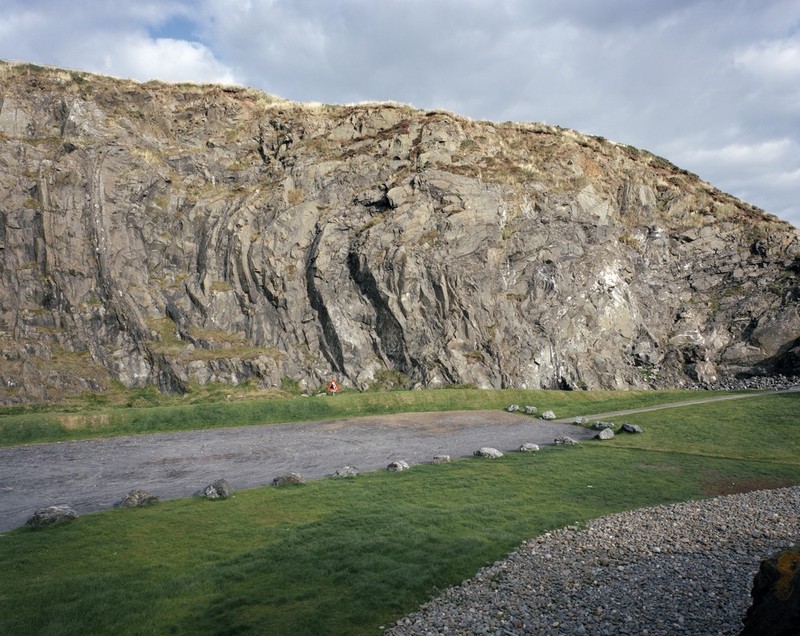
| 13:48, 9 December 2015 | P259023.jpg (file) |  |
289 KB | Ringdoo Point. F1 folding. P259023 | 1 |
| 13:36, 9 December 2015 | P008437.jpg (file) |  |
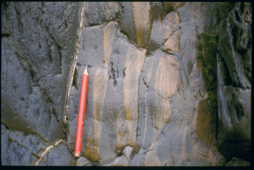
471 KB | Shore S. of Low Auchenlarrie (Boatdraught). Deformed sand volcanoes on top of sandstone bed. A bedding plane with numerous small sand volcanoes, many of which preserve a central hollow. The sand volcanoes have been distorted from their original circula... | 1 |
| 13:04, 9 December 2015 | P259111.jpg (file) |  |
299 KB | Gipsy Point. Sand volcano, (0986/29, rack 2). P259111 | 1 |
| 13:02, 9 December 2015 | P258913.jpg (file) |  |
241 KB | Gipsy Point. Sand volcano. P258913 | 1 |
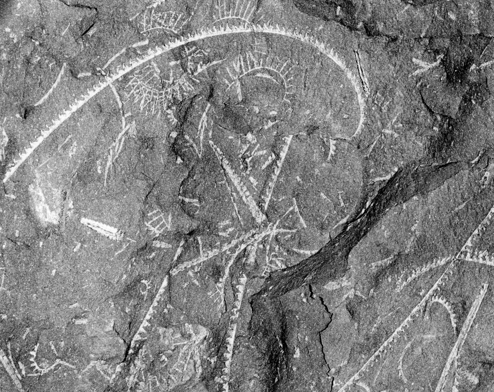
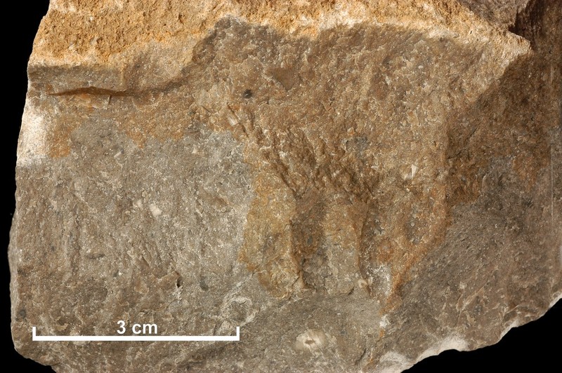
| 12:34, 9 December 2015 | P772042.jpg (file) |  |
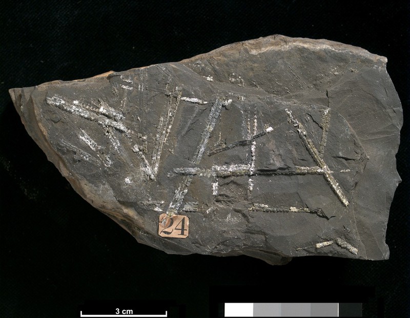
389 KB | Silurian (Llandovery) graptolites from southern Scotland. Locality is probabably Dob's Linn, Moffatdale. 1:50 k sheet 16E (Ettrick), NT 196 158. P772042 | 1 |
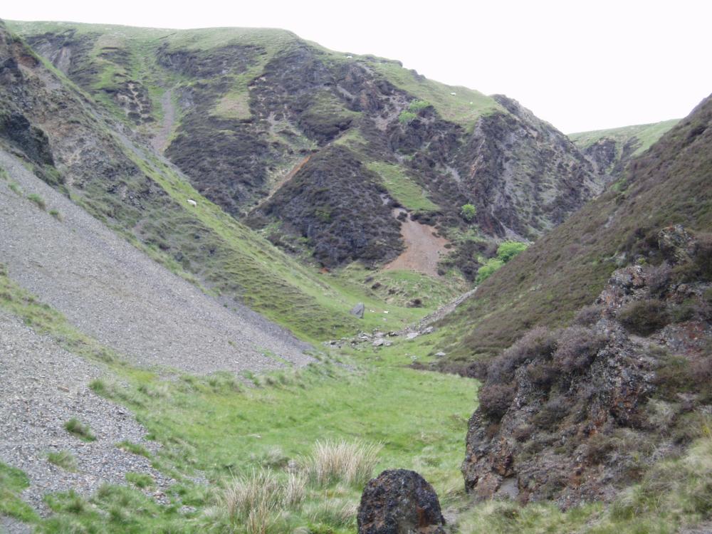
| 11:22, 9 December 2015 | P571542.jpg (file) |  |
129 KB | View towards Dob's Linn, Moffatdale, Main Branch round spur on right, Linn Branch on left in from of red scar. P571542 | 1 |
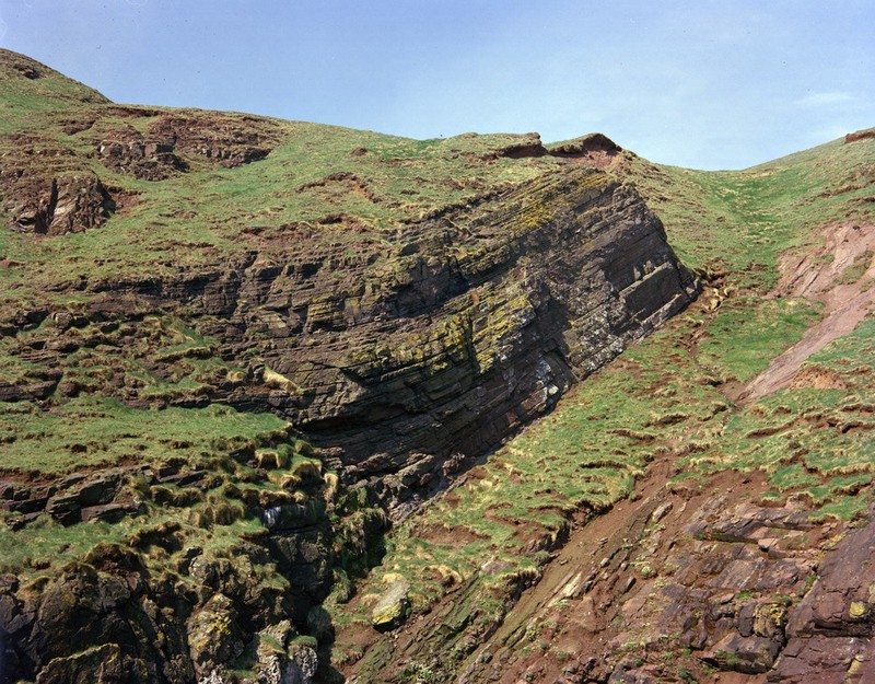
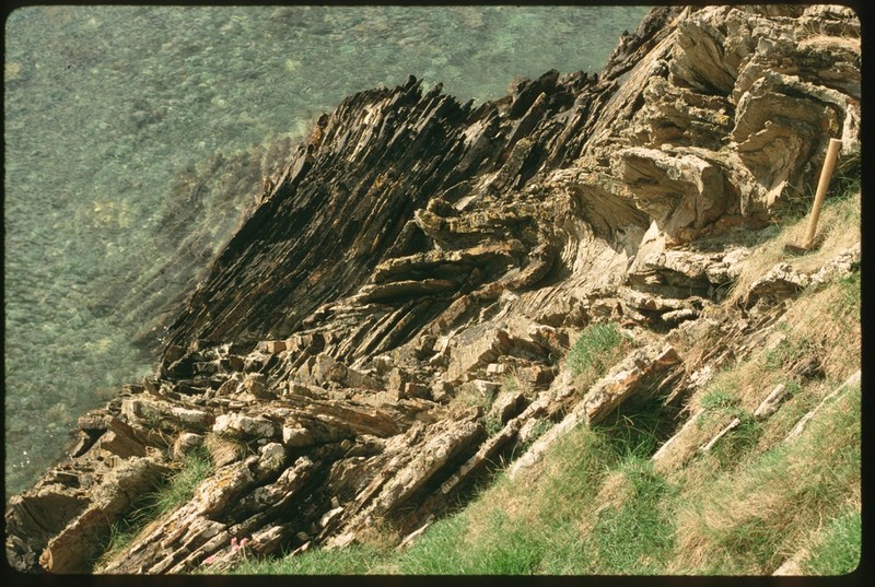
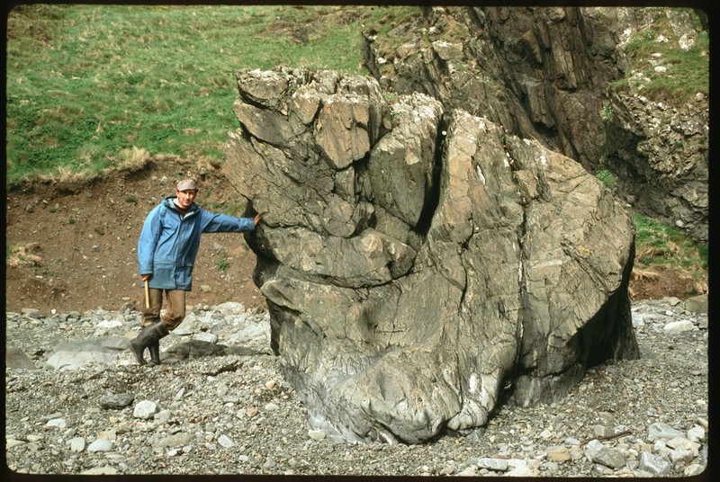
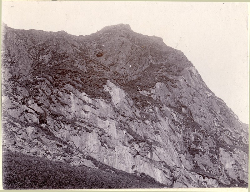
| 13:16, 17 November 2015 | P219962.jpg (file) |  |
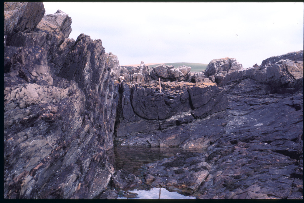
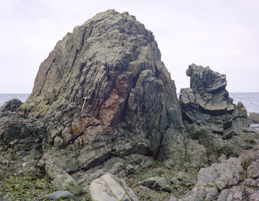
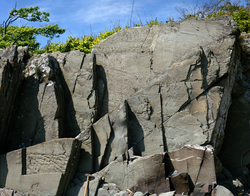
313 KB | Coast N. of Ballantrae, Bennane Lea. Tight, upright folds in bedded chert. The hinge of a synform is well exposed in the smaller stack on the right of the photograph. | 1 |
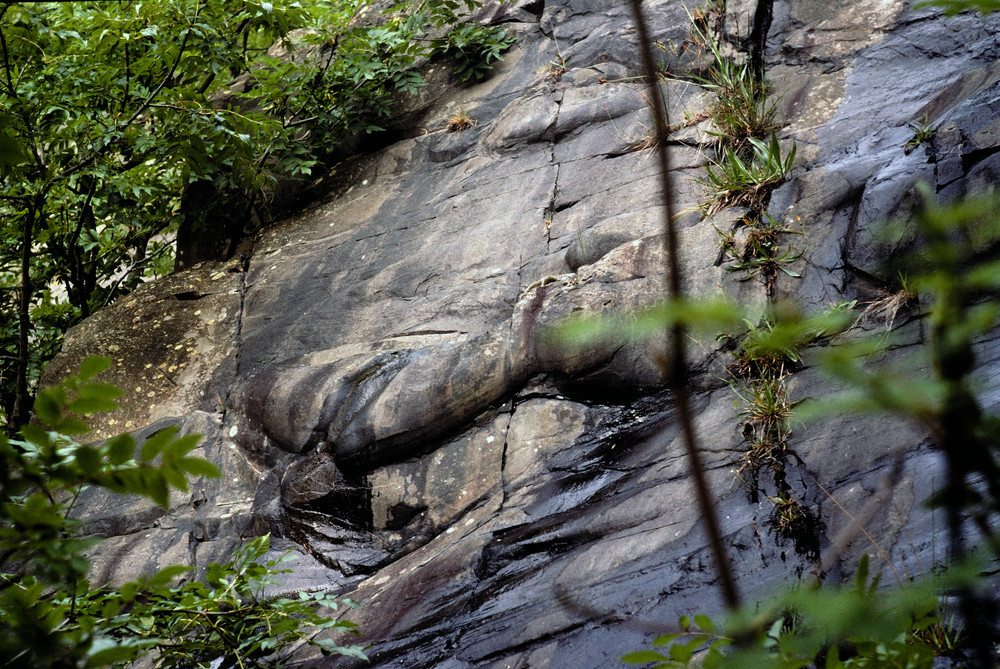
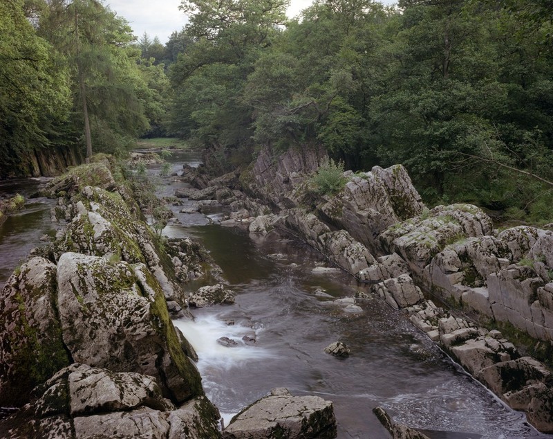
| 12:50, 17 November 2015 | P266078.jpg (file) |  |
393 KB | Cowpeel Bridge, Peebles. Flutes in greywacke. | 1 |
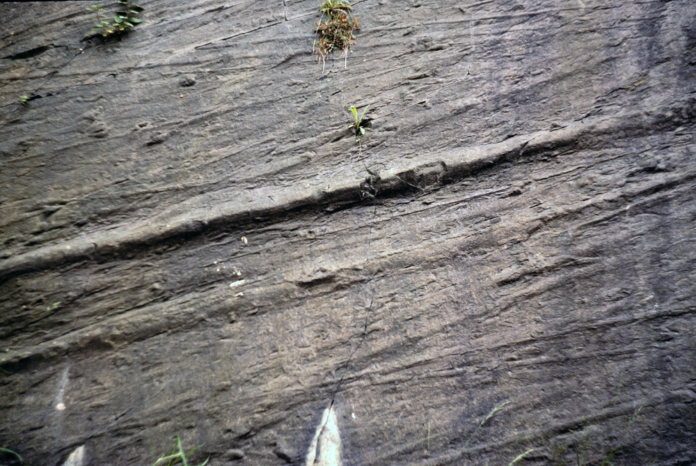
| 12:36, 17 November 2015 | P266073.jpg (file) |  |
295 KB | Pirn Quarry, Innerleithen. Grooves in greywacke. | 1 |
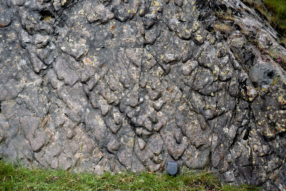
| 12:32, 17 November 2015 | P266075.jpg (file) |  |
344 KB | Pirn Quarry, Innerleithen. Big bulbous flutes. | 1 |
| 11:25, 17 November 2015 | P259084.jpg (file) |  |
195 KB | Meikle Ross. Ripples - cross-bedded, Ross Formation. | 1 |
| 11:15, 17 November 2015 | P220425.jpg (file) |  |
352 KB | Brighouse Bay, 3 km. S. of Borgue. Looking W. Flute casts and grooves on base of greywacke beds - axial current (from north-east). Carghidown Formation, Hawick Group. | 1 |
| 11:16, 10 November 2015 | P001124.jpg (file) |  |
156 KB | Isle of Whithorn viewed looking south-east across Isle of Whithorn Bay towards the South Pier of the harbour. Geologically it is part of the extensive outcrop of Lower Palaeozoic strata which forms the Southern Uplands of Scotland. Greywackes are the d... | 1 |
| 11:10, 10 November 2015 | P008407.jpg (file) |  |
154 KB | Burrow Head. Looking N. Red mudstones in Carghidown Formation. Unusually thick red mudstone beds in steeply-dipping, locally disrupted greywackes of the Carghidown Formation, Hawick Group. | 1 |
| 17:15, 27 October 2015 | P906517.jpg (file) |  |
136 KB | Cementstone Group. Hutton Castle Barns BH [NT85SE/1], 248 yards south 16 degrees east of Hutton Castle Barns and 20 yards north of bank of Cabby Burn; depth 70 - 75 fm. P906517 | 1 |
| 17:04, 27 October 2015 | P218956.jpg (file) |  |
175 KB | Chirnside, East Blanerne. Looking SE. Mudstones and cementstones of Lower Carboniferous dipping to south at 12 degrees. South-east view. P218956 | 1 |
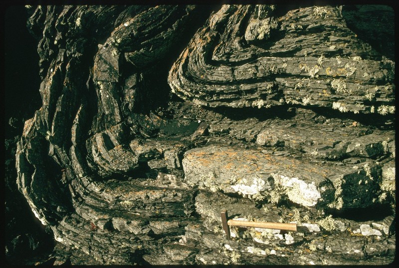
| 16:55, 27 October 2015 | P220053.jpg (file) |  |
378 KB | Hawick road section, 2 km. SE of Tushielaw, Ettrick. Looking E. Folded greywackes. Southern half of Hawick road section showing folds 3 (anticline), 4 (syncline) and 5 (imbricated) in greywacke sandstones of the Gala Group. P220053 | 1 |
| 16:06, 27 October 2015 | P005892.jpg (file) |  |
215 KB | St. Abb's Head, Cauldron Cove. View SW. Grits and lava. Bedded tuffaceous grit (c. 27 m. thick) dips to left and overlies massive lava (lower left). The lava appears to be thrust over bedded grits in right foreground. Lower Old Red Sandstone. P005892 | 1 |
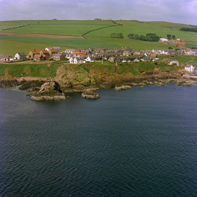
| 15:52, 27 October 2015 | P000813.jpg (file) |  |
172 KB | Oblique aerial view of St. Abb's from the east. Berwickshire. The rocks in the foreground are intrusive porphyrites and agglomerates. The rocks on the shore are intrusive porphyrites and unbedded agglomerates, probably within a volcanic vent, of Lower... | 1 |
| 15:19, 27 October 2015 | P220465.jpg (file) |  |
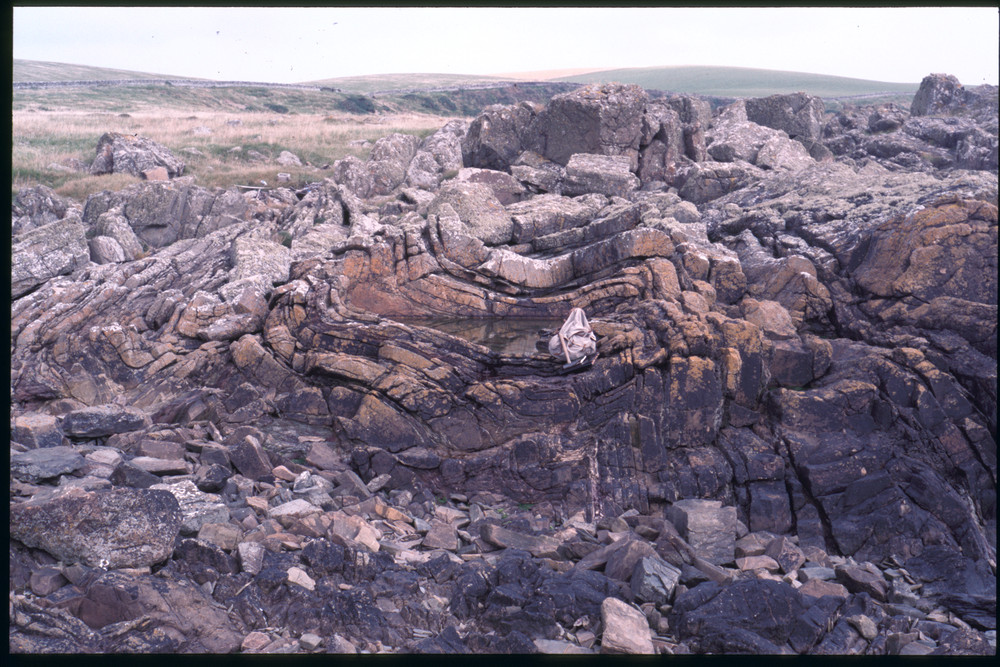
373 KB | Taken from 300 m. S. of Hogus Point, Carsethorne. Looking NNE, across the estuary of the River Nith. Arbigland Limestone Formation. Plunging anticlinal-synclinal pair in thin-bedded limestones and sandstones. P220465 | 1 |
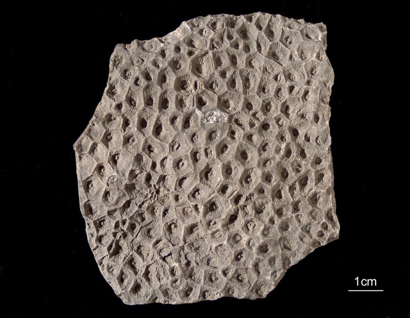
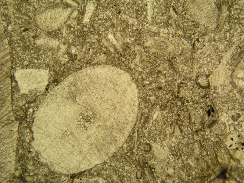
| 15:13, 27 October 2015 | P511132.jpg (file) |  |
128 KB | Lithostrotion vorticale: a coral from Arbigland Bay. P511132 | 1 |
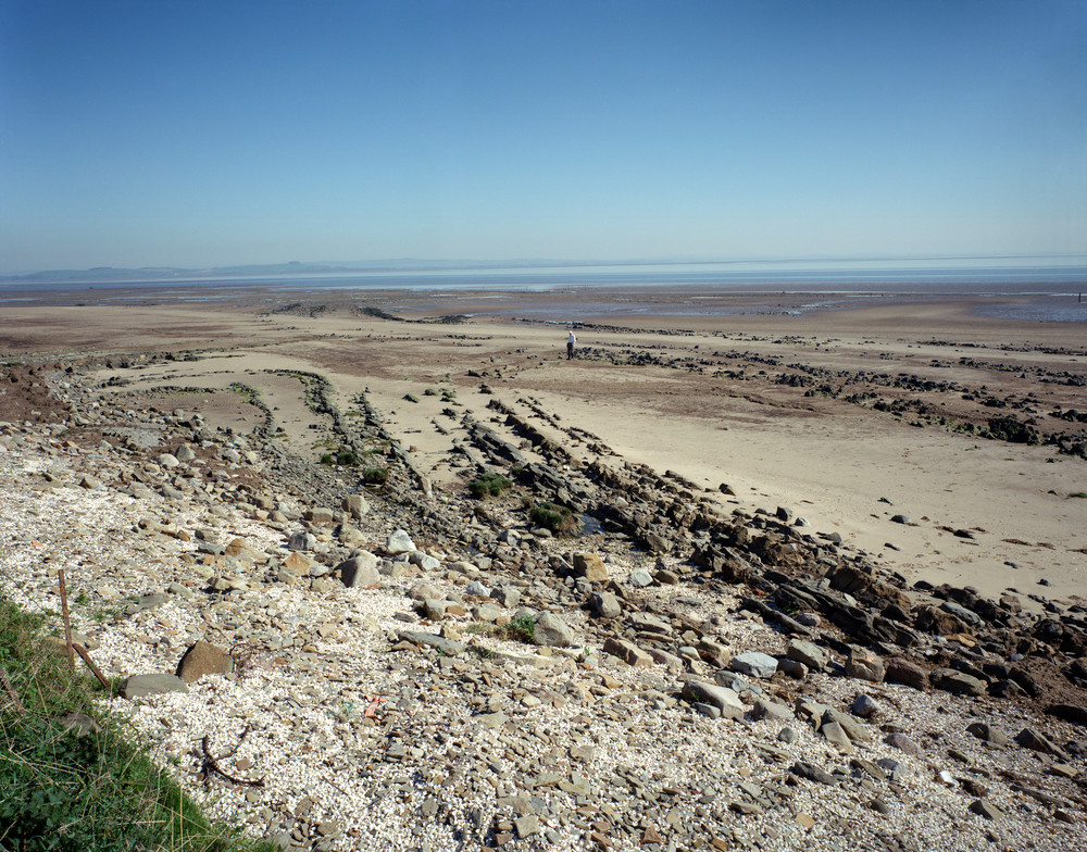
| 10:15, 20 October 2015 | P000823.jpg (file) |  |
184 KB | Siccar Point, eastward view. Berwickshire. Unconformity between Upper Old Red Sandstone and the underlying Silurian (Llandovery) age rocks. Dark red sandstones and breccias of the Upper Old Red Sandstone age dip at low angles to the north and rest unco... | 1 |
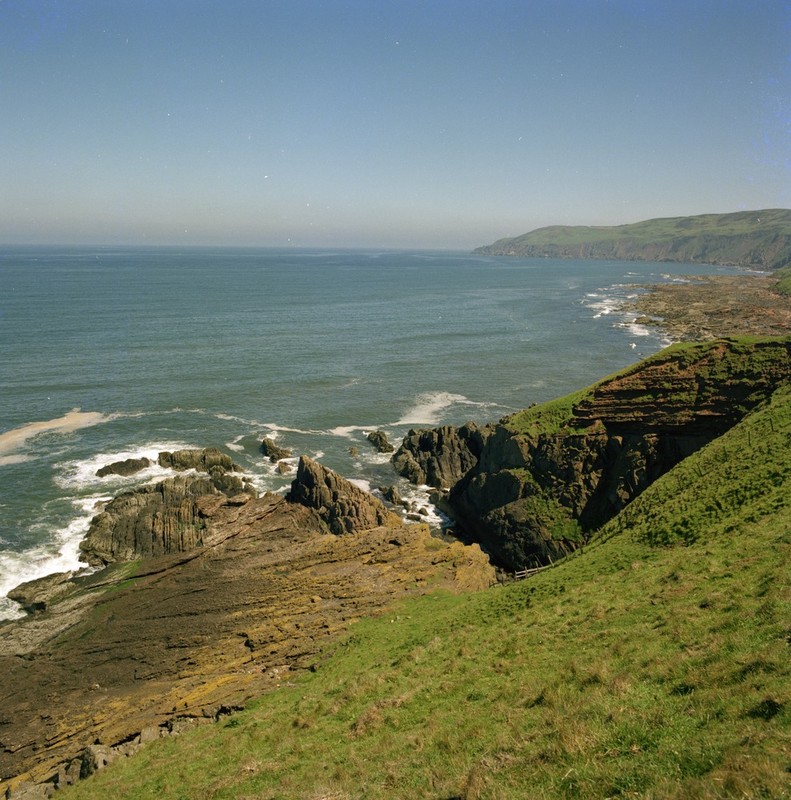
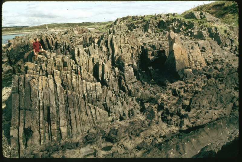
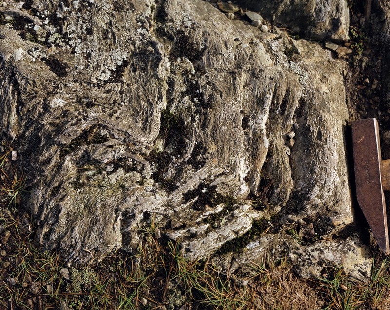
| 10:50, 13 October 2015 | P008512.jpg (file) |  |
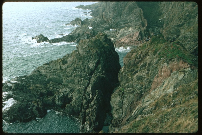
193 KB | West Tarbet, Mull of Galloway. Steeply-plunging minor folds in greywackes of the Hawick Group, Silurian. P008512 | 1 |
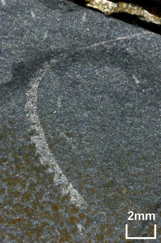
| 10:43, 13 October 2015 | P521155.jpg (file) |  |
192 KB | A fossil specimen of Monograptus limatulus. A fossil graptolite. (Graptolithina.) Clanyard Bay, south side, Wigtownshire, Scotland. This specimen of Monograptus limatulus is from the convolutus Biozone of the Silurian and was found on the south side of... | 1 |
| 10:31, 13 October 2015 | P008467.jpg (file) |  |
178 KB | Port Logan, sea cliffs on S. side of bay. Tertiary dolerite dyke. Cuts orthogonally across thin greywacke beds of the Lower Silurian Port Logan Formation. Greywackes are vertical, strike 060 degrees south-east. Dyke trends north-west to south-east. P00... | 1 |
| 10:22, 13 October 2015 | P008490.jpg (file) |  |
191 KB | S. side of The Hoolies, Ardwell Bay. Steeply-plunging fold in thin-bedded greywackes of the Garheugh Formation, Silurian. P008490 | 1 |
| 10:14, 13 October 2015 | P008482.jpg (file) |  |
207 KB | Ardwell Bay, N. side. Anticline in greywackes of the Garheugh Formation, Silurian. Fold hinge plunges gently south-west. P008482 | 1 |
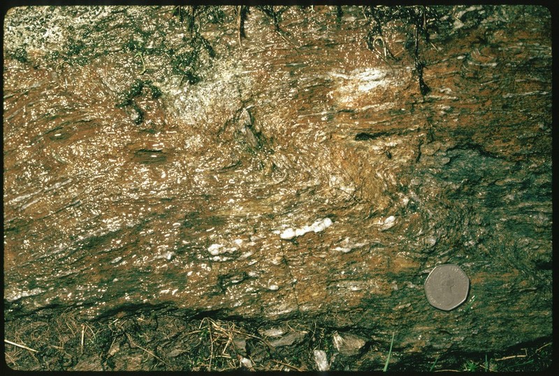
| 09:58, 13 October 2015 | P552675.jpg (file) |  |
206 KB | North Greens (No. 2) Limestone. Bents Quarry, 600 yards north of Macbiehill House. Peebles. Fawn-grey, compact limestone composed of fragments of crinoids, shells and polyzoa in a turbid base partly of granular calcareous debris, partly pelitomorphic c... | 1 |
| 13:40, 6 October 2015 | P008429.jpg (file) |  |
180 KB | Portpatrick Quarry. Monocline in greywackes. The attitude of the Portpatrick Formation greywackes changes from sub-horizontal at the top of the cliff to vertical at the base. P008429 | 1 |
| 13:31, 6 October 2015 | P008516.jpg (file) |  |
194 KB | Killantringan Bay. Synclinal fold hinge in greywackes of the Portpatrick Formation, Ordovician. P008516 | 1 |
| 13:10, 6 October 2015 | P509358.jpg (file) |  |
201 KB | Well-developed rodding in greywacke associated with the Moniaive Shear Zone, Dalry from Corriedoo Forest Road. P509358 | 1 |
| 13:01, 6 October 2015 | P008450.jpg (file) |  |
277 KB | Murray's Monument, A712 Newton Stewart to New Galloway Road. Foliated meta-greywacke. Steeply plunging dextral kink band in foliated meta-greywacke with fine quartz veins parallel to fabric. Cairnsmore of Fleet granite aureole. P008450 | 1 |
| 12:56, 6 October 2015 | P008445.jpg (file) |  |
221 KB | Wood of Dervaird, 2 km. E. of Glenluce. Sinistral fold pair in cleaved and veined siltstone. View down hinges of steeply-plunging sinistral fold pair which deforms cleavage and fine veins and knots of quartz in a fault zone. P008445 | 1 |
| 12:51, 6 October 2015 | P248524.jpg (file) |  |
186 KB | Talnotry, NE of Newton Stewart. Junction of Cairnsmore-of-Fleet granite with overlying Silurian grit. P248524 | 1 |
| 12:41, 6 October 2015 | P527792.jpg (file) |  |
178 KB | Limestone from Bent's Quarry, Macbiehill, Peeblesshire. A medium-grained limestone containing a few what are though to be crinoids weathering to pale brown from Bent's Quarry, 700 yards south of Macbiehill, Peeblesshire. Macbiehill Quarry is in close p... | 1 |
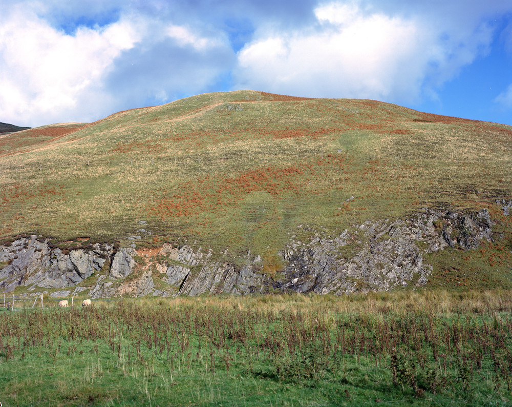
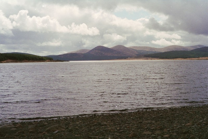
| 12:22, 6 October 2015 | P509338.jpg (file) |  |
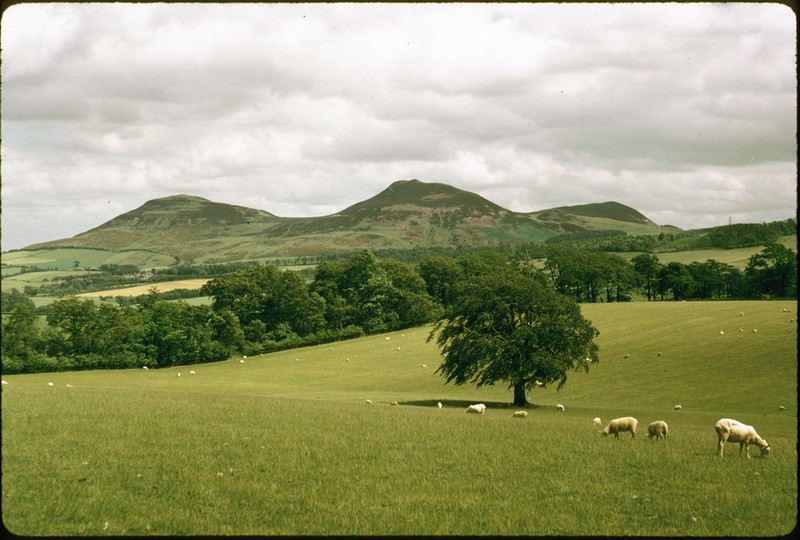
120 KB | Loch Doon, Ayrshire/Kirkcudbrightshire border. Looking south-south-east from dam. Black Craig in centre with Coran of Portmark, then Boe, then Meaul, and then Carlins Cairn to the right. P509338 | 1 |
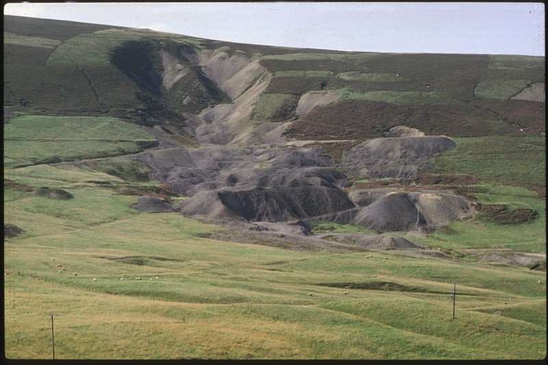
| 11:55, 6 October 2015 | P266685.jpg (file) |  |
123 KB | Leadhills, Lanarkshire. Manner' Scar, Susanna Vein. P266685 | 1 |
| 09:58, 6 October 2015 | P220174.jpg (file) |  |
202 KB | Penton Linns, Liddell Water, 2.5 m. ENE of Canonbie. Steeply-dipping limestones (Upper Liddlesdale Group). P220174 | 1 |
| 09:47, 6 October 2015 | P220173.jpg (file) |  |
195 KB | River Esk, Skipper's Bridge, Langholm. Birrenswark Lavas, forming the foundations for Skipper's Bridge, Langholm. P220173 | 1 |
| 09:39, 6 October 2015 | P218294.jpg (file) |  |
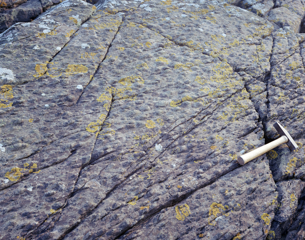
159 KB | Pedens View Quarry, 2.6 km. NW of Langholm. Groove casts, bifurcating and groove in groove structure. | 1 |
| 09:33, 6 October 2015 | P218281.jpg (file) |  |
185 KB | Peden's View Quarry, 2.6 km. NW of Langholm. Tight fold in massive and flaggy greywackes. P218281 | 1 |
| 10:27, 29 September 2015 | P002488.jpg (file) |  |
73 KB | Smailholm Tower near Smailholm, Roxburgh. Basalt intrusion of Lower Carboniferous age. Crags of basalt forming part of roughly circular volcanic neck intruded into the 'Kelso Traps'. These are basalt lavas of Carboniferous age thought to be contemporar... | 1 |
| 10:08, 29 September 2015 | P000584.jpg (file) |  |
111 KB | The Eildon Hills, near Melrose, from the north-west. Roxburghshire. The hills are the denuded remains of a composite laccolith of trachyte rocks intruded into the Upper Old Red Sandstone in Carboniferous times. Much of Eildon Wester and Eildon Mid is f... | 1 |
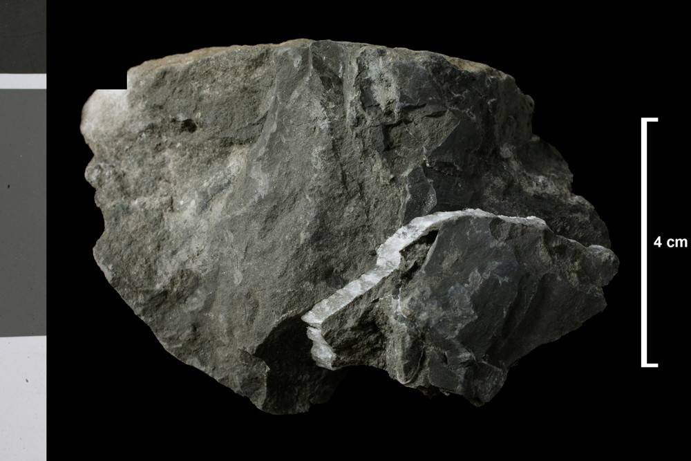
| 20:51, 3 August 2015 | P521486.jpg (file) |  |
126 KB | Rock specimen of shale. Glenkiln Burn, Kirkmichael, Dumfriesshire. The sample is a black shale containing graptolite fossils on bedding surfaces. The shale is very fine-grained and thinly bedded. British Geological Survey Petrology Collection sample nu... | 1 |