Uploads by JenniferFindlay1
Jump to navigation
Jump to search
This special page shows all uploaded files.
| Date | Name | Thumbnail | Size | Description | Versions |
|---|---|---|---|---|---|
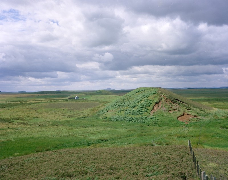
| 15:22, 29 June 2015 | P000940.jpg (file) |  |
120 KB | Bedshiel Kaims. Berwickshire. North-east end of the esker, known as Bedshiel Kaims. The view looking to the south-west shows 'Horse Kaim' and on the left of the picture, in shadow, 'Green Kaims'. The esker varies in height between 6 m. and 12 m. above... | 1 |
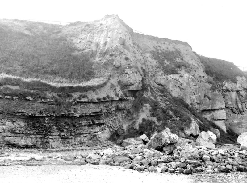
| 16:03, 29 June 2015 | P202991.jpg (file) |  |
139 KB | Green's Haven, Berwick-on-Tweed. Looking NW. Green's Haven Fault, 400 ft. down south. Lower and Middle Limestone Group (Lower Carboniferous Measures). P202991 | 1 |
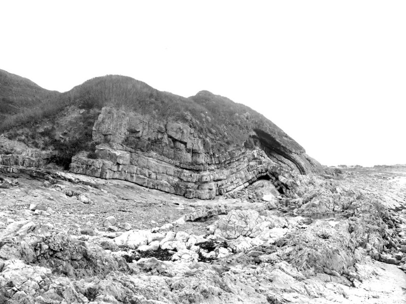
| 16:22, 29 June 2015 | P202993.jpg (file) |  |
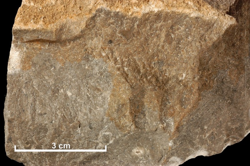
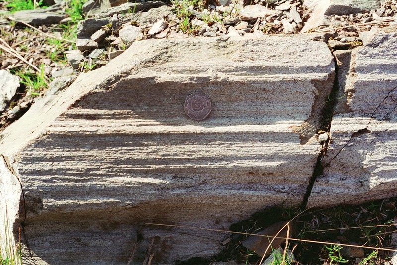
138 KB | On foreshore, Scremerston. Looking N. Contorted Eelwell Limestone, Middle Limestone Series (Lower Carboniferous). P202993 | 1 |
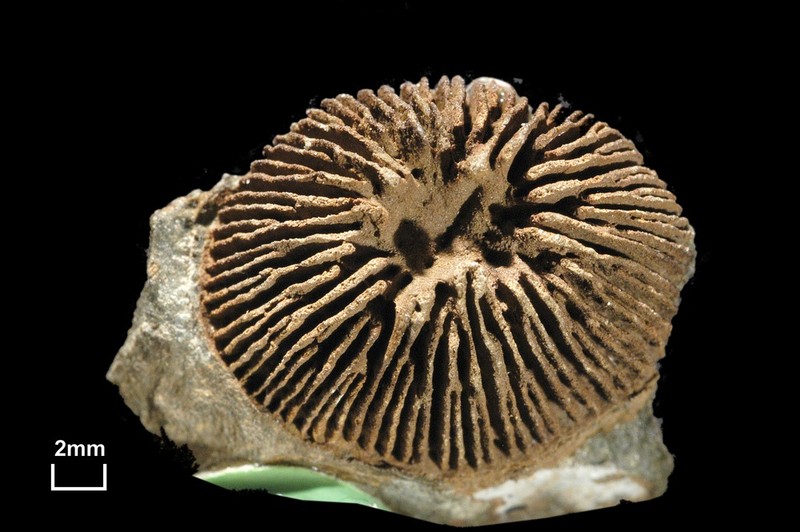
| 19:52, 6 July 2015 | P521144.jpg (file) |  |
99 KB | A fossil specimen of Kilbuchophyllia clarksoni Scrutton. A fossil coral. (Coelenterata, Anthozoa, Zoantharia.) Wandel Burn at Wallace's Cast 2.75 miles north-east of Abington, Lanarkshire, Scotland. This specimen of Kilbuchophyllia clarksoni is a cora... | 1 |
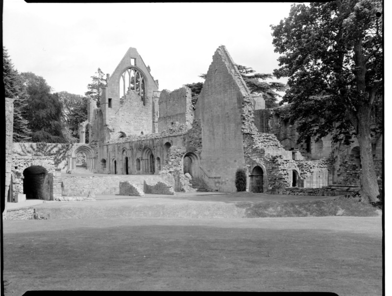
| 20:33, 6 July 2015 | P002732.jpg (file) |  |
121 KB | Dryburgh Abbey, about 1 km. east of Newtown St. Boswells, Borders. The abbey is built of local pink sandstones of the 'Upper Old Red Sandstone' which are late Devonian to early Carboniferous in age. It is a relatively easily worked stone and weathers t... | 1 |
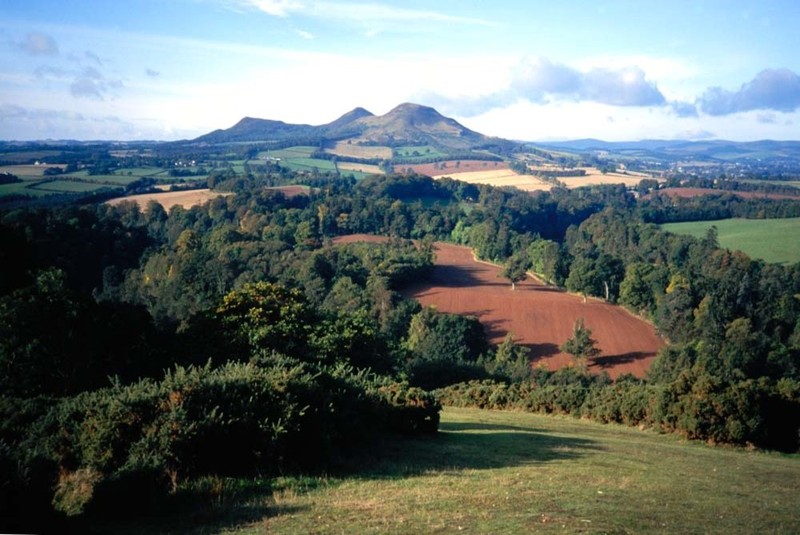
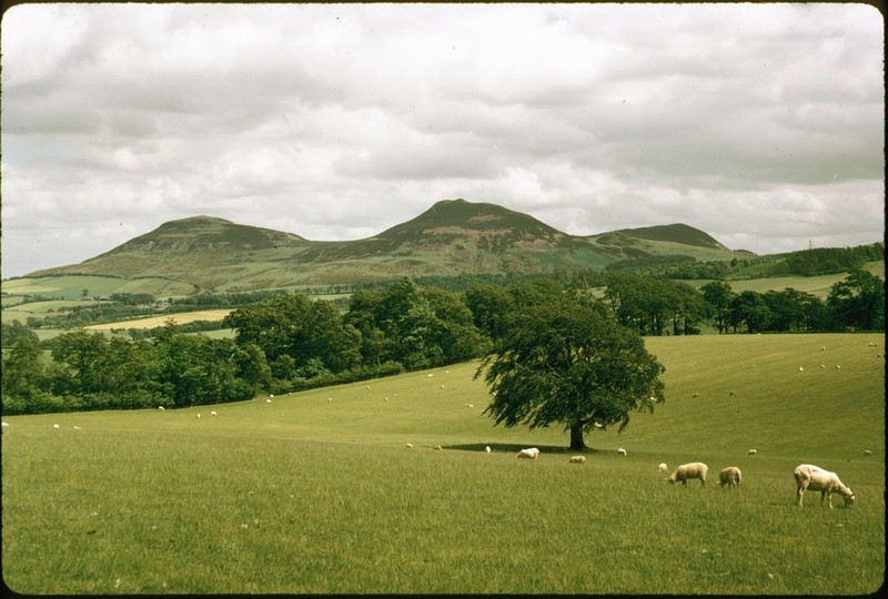
| 20:40, 6 July 2015 | P613418.jpg (file) |  |
113 KB | Eildon Hills from Scott's View. P613418 | 1 |
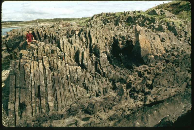
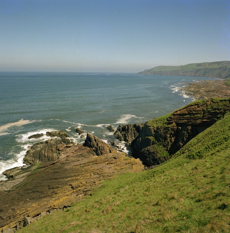
| 18:39, 12 July 2015 | P002734.jpg (file) |  |
119 KB | Vertical strata on wave-cut platform at Burnmouth Harbour, looking north, 3 km. south of Eyemouth, Berwickshire. These are vertical strata of the Lower Carboniferous 'Cementstone Group' downfaulted against the Silurian rocks which form the cliffs in th... | 1 |
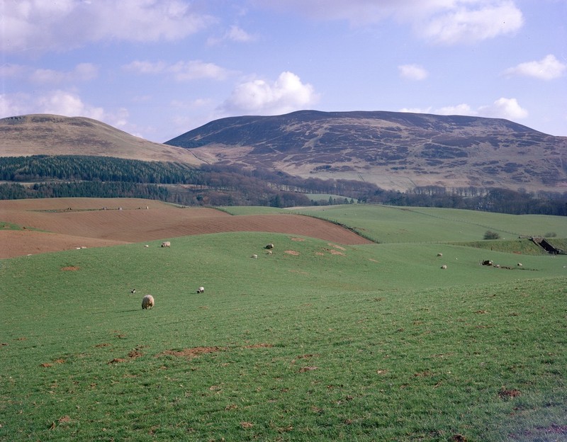
| 19:32, 12 July 2015 | P002746.jpg (file) |  |
93 KB | Eye Valley above Reston, looking east, Berwickshire. The viewpoint is on steep slopes underlain by Silurian greywackes and similar rocks, capped locally by Upper Old Red Sandstone conglomerate, which forms the distant skyline of Ayton Hill and Lamberto... | 1 |
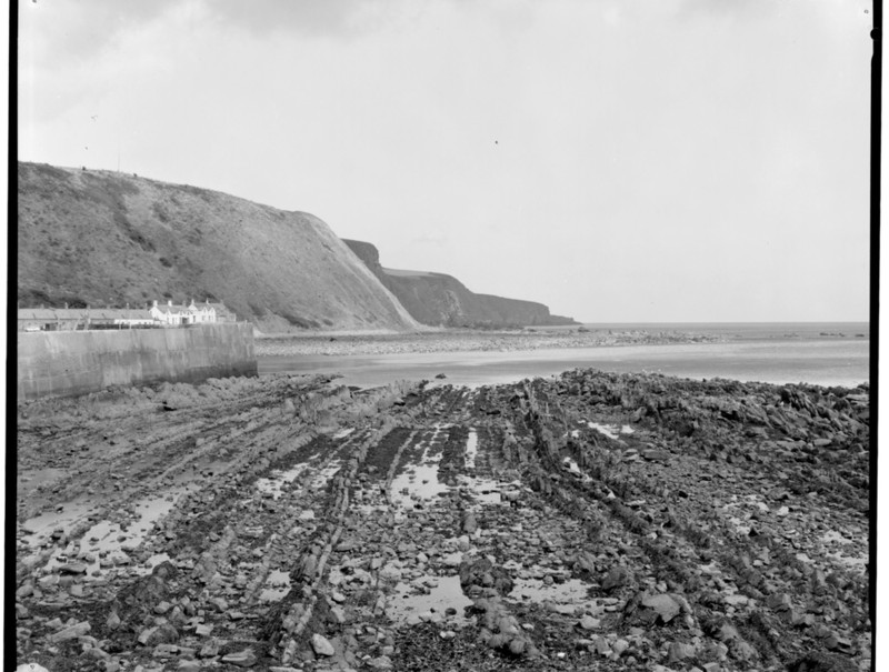
| 20:04, 12 July 2015 | LambertonBeach.JPG (file) |  |
2.04 MB | Lamberton Beach, looking south from the Old Fishery. | 1 |
| 20:20, 12 July 2015 | HiltonBay.JPG (file) |  |
2.9 MB | Near vertical N-S strata exposed in Hilton Bay. Looking E. | 1 |
| 20:53, 12 July 2015 | HiltonBayLithostrotionjunceum.jpg (file) |  |
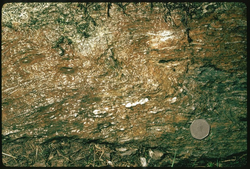
3.64 MB | Hilton Bay, 7 km. N of Berwick-upon-Tweed. Weathered limestone with Lithostrotion junceum, a colonial coral. | 1 |
| 19:43, 13 July 2015 | P002787.jpg (file) |  |
105 KB | Windy Gowl, Carlops, Lothian Region. Glacial drainage channel. The Pentland Hills can be seen in the distance. A complex glacial drainage channel with rocky 'islands'. It is thought that the complex of meltwater channels was used by meltwaters during t... | 1 |
| 19:51, 13 July 2015 | P000977.jpg (file) |  |
170 KB | Nicks Plantation Sandpit, near Dolphinton. Lanarkshire. Kippit Hill, Dolphinton. Looking south. A prominent mound of glacial meltwater sand. The mound forms the south-east extension of the Dolphinton Gap deposits. The sediments are thought to have been... | 1 |
| 19:56, 13 July 2015 | P000974.jpg (file) |  |
142 KB | South-south-west of Easton Farm, Dunsyre. Lanarkshire. Kames of the Dolphinton Gap. Part of the series of mounds of meltwater sands and gravels which accumulated amidst bodies of stagnant ice in the valley of the South Medwin. To the south is Black Mou... | 1 |
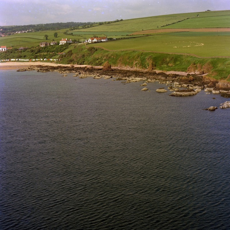
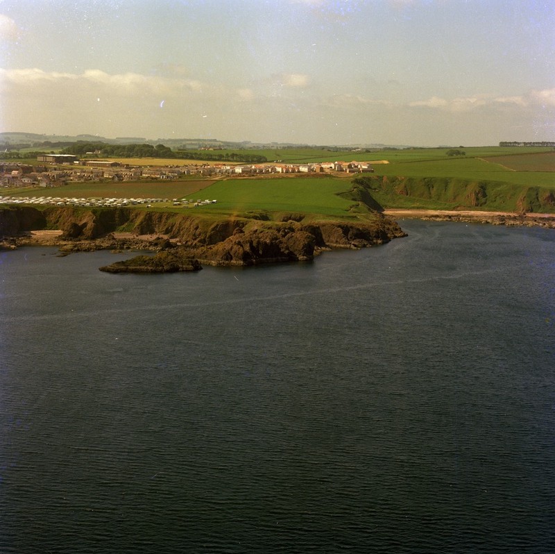
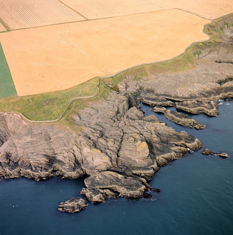
| 14:35, 19 July 2015 | P000812.jpg (file) |  |
187 KB | Oblique aerial view of Coldingham Bay viewed from the east. Berwickshire. The white buildings with the red roofs are at St. Abb's Haven. Intrusive porphyrites and agglomerates. The rocks on the shore are intrusive porphyrites and unbedded agglomerates,... | 1 |
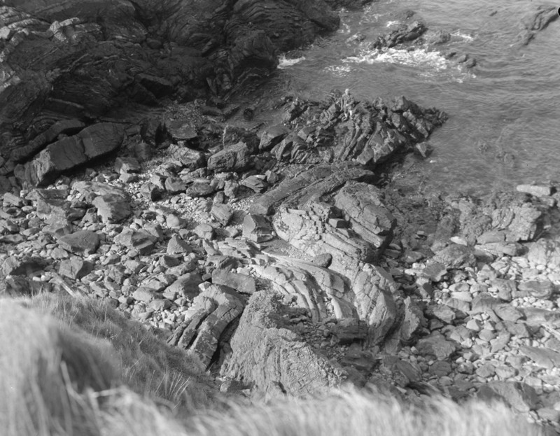
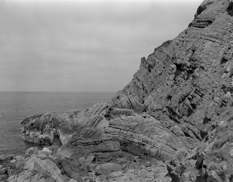
| 14:58, 19 July 2015 | P218963.jpg (file) |  |
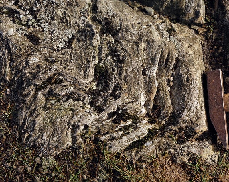
155 KB | Linkim Shore, Yellow Craig. Looking SE. Tight folding in greywackes of 'Coldingham Beds' (Silurian). The axial plane and the bedding dip at c. 50 degrees to north-east: the fold axes plunge northwards at about 40 degrees. | 1 |
| 19:16, 20 July 2015 | P008564.jpg (file) |  |
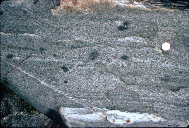
187 KB | Graddoch Burn. Cairnsmore of Fleet granite aureole. Cordierite pseudomorphs in meta-sandstone. Cordierite pseudomorphs in biotite hornfels, are flattened and aligned in cleavage oblique to the relict sedimentary lamination. | 1 |
| 19:26, 20 July 2015 | P248526.jpg (file) |  |
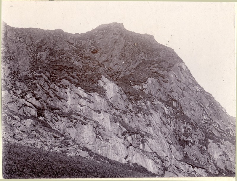
86 KB | Cairnsmore-of-Fleet from the Talnotry Road. Great granite intrusion. | 1 |
| 19:43, 27 July 2015 | P000809.jpg (file) |  |
147 KB | Oblique aerial view of Hairy Ness, Eyemouth taken from the north-east. Berwickshire. The headland is made up of andesitic and basaltic lavas of Lower Old Red Sandstone age with some beds of coarse agglomerate. The less prominent rocks of Killiedraught... | 1 |
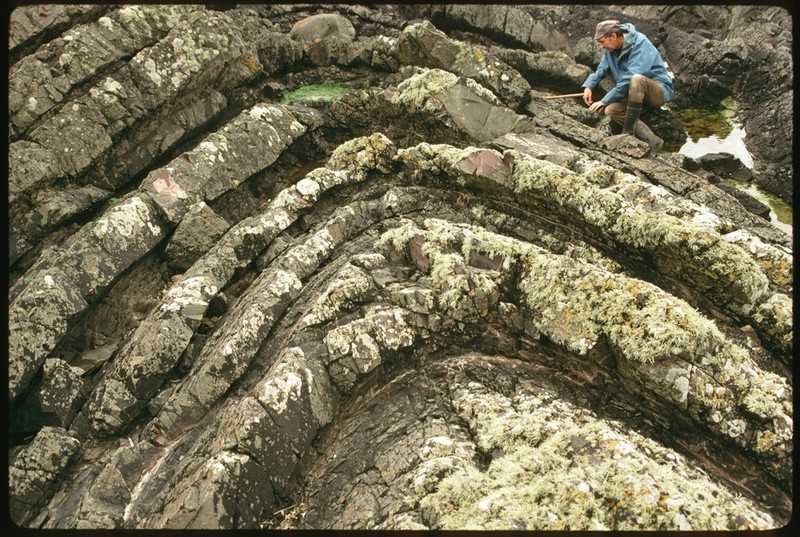
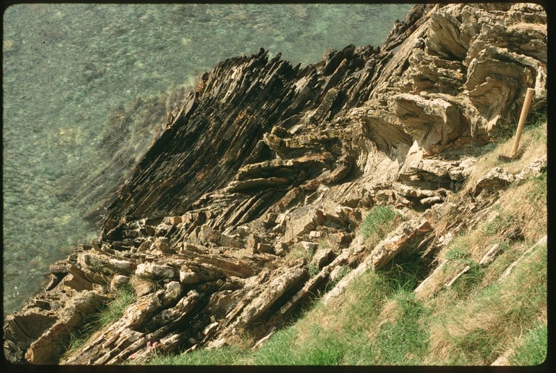
| 19:52, 27 July 2015 | P218976.jpg (file) |  |
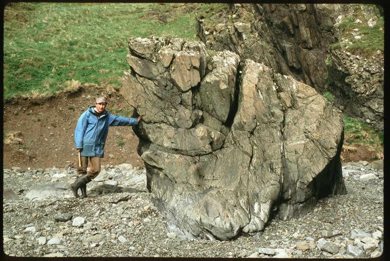
152 KB | Eyemouth, Agate Point. Downward view to N. Folds in Silurian greywacke. The rounded crest of an anticline in centre plunges almost vertically to south-west. The figure is standing on the axis of a tight syncline with a more gentle parallel plunge. P218976 | 1 |
| 20:03, 27 July 2015 | P002933.jpg (file) |  |
197 KB | Oblique aerial view from the east-south-east taken at Whalt Point - Willie Anderson, Eyemouth shore, Berwickshire. The rocks, typical turbidites, are an alternating series of greywackes and siltstones in beds seldom exceeding 0.5 m. in thickness. They... | 1 |
| 21:25, 27 July 2015 | P005882.jpg (file) |  |
257 KB | Dowlaw Burnfoot. Syncline. South-west view of syncline in Silurian greywackes. P005882 | 1 |
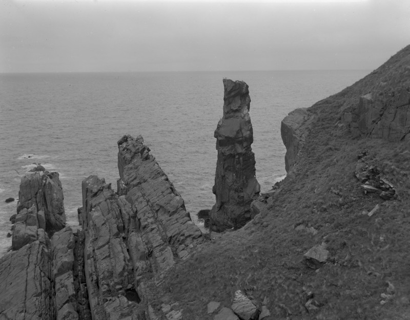
| 21:30, 27 July 2015 | P218932.jpg (file) |  |
98 KB | Souter, Dowlaw. A stack c. 15 m. high in a band of Silurian greywacke c.18 ft. thick. The vertical beds young towards the south-east, right in photograph. P218932 | 1 |
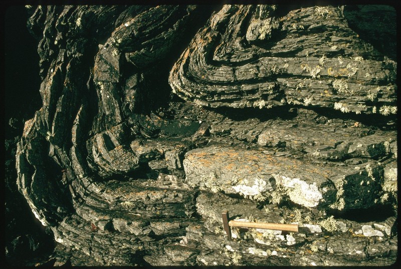
| 21:42, 27 July 2015 | P218931.jpg (file) |  |
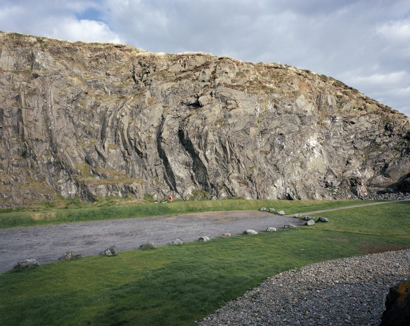
127 KB | Fast Castle. Complex syncline and anticline in Silurian greywacke. Low axial plunge, generally to south-west, towards camera. P218931 | 1 |
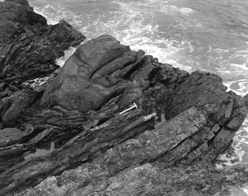
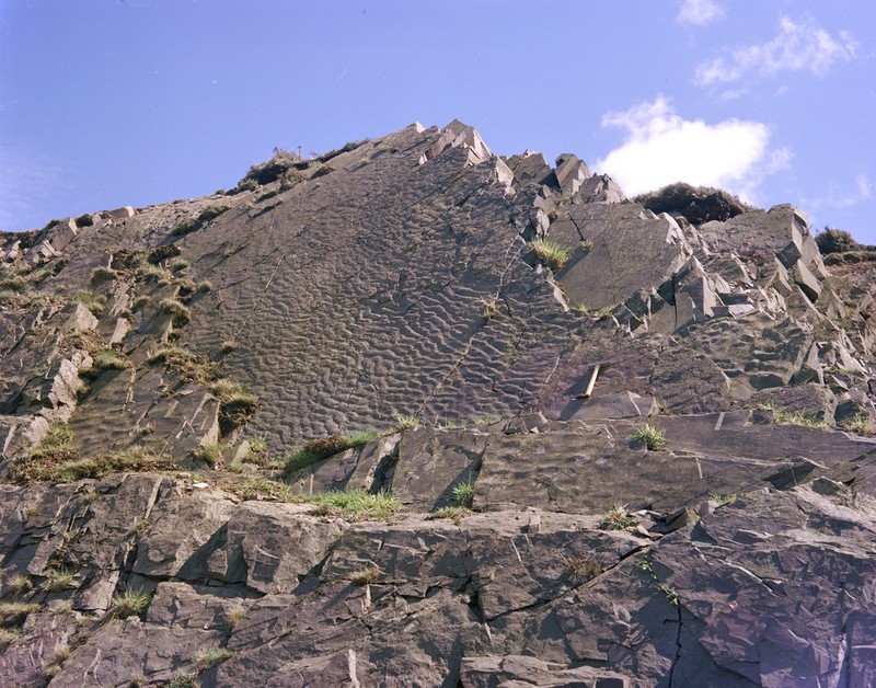
| 21:48, 27 July 2015 | P005884.jpg (file) |  |
187 KB | Harly Darlies, Dowlaw. Ripple marks on Silurian greywacke. The beds dip at 55 degrees to north-west. The marks appear to have been formed by currents flowing from bottom left to top right. Sub-parallel development on several bedding-planes. P005884 | 1 |
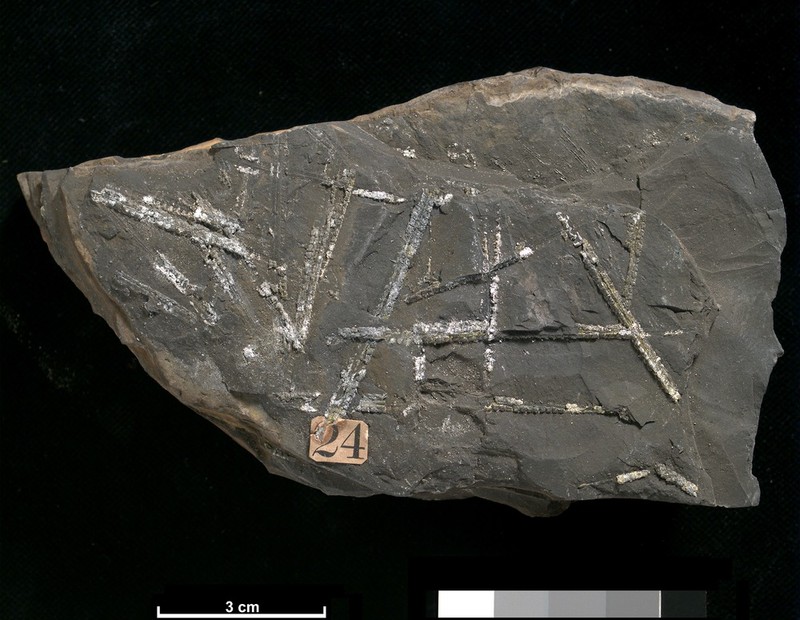
| 20:23, 3 August 2015 | P521164.jpg (file) |  |
126 KB | A fossil specimen of Dimorphograptus decussatus. A fossil graptolite. (Graptolithina.) Port Gower, Grennan Point, Wigtownshire, Scotland. This specimen of graptolite, Dimorphograptus decussatus is possibly from the atavus Biozone of the Silurian and wa... | 1 |
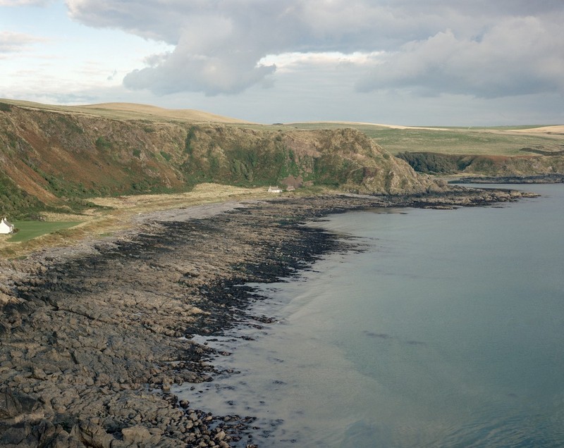
| 20:37, 3 August 2015 | P001122.jpg (file) |  |
132 KB | Morroch Bay, Wigtownshire viewed from the north-west. The bay and the smaller Port of Spittal Bay beyond are eroded along the outcrop of shale sequences which alternate with Portpatrick Formation (Ordovician) greywackes. The rocks are all steeply incli... | 1 |
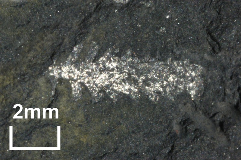
| 20:51, 3 August 2015 | P521486.jpg (file) |  |
126 KB | Rock specimen of shale. Glenkiln Burn, Kirkmichael, Dumfriesshire. The sample is a black shale containing graptolite fossils on bedding surfaces. The shale is very fine-grained and thinly bedded. British Geological Survey Petrology Collection sample nu... | 1 |
| 10:08, 29 September 2015 | P000584.jpg (file) |  |
111 KB | The Eildon Hills, near Melrose, from the north-west. Roxburghshire. The hills are the denuded remains of a composite laccolith of trachyte rocks intruded into the Upper Old Red Sandstone in Carboniferous times. Much of Eildon Wester and Eildon Mid is f... | 1 |
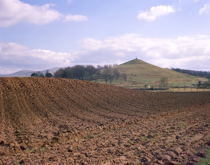
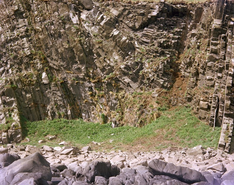
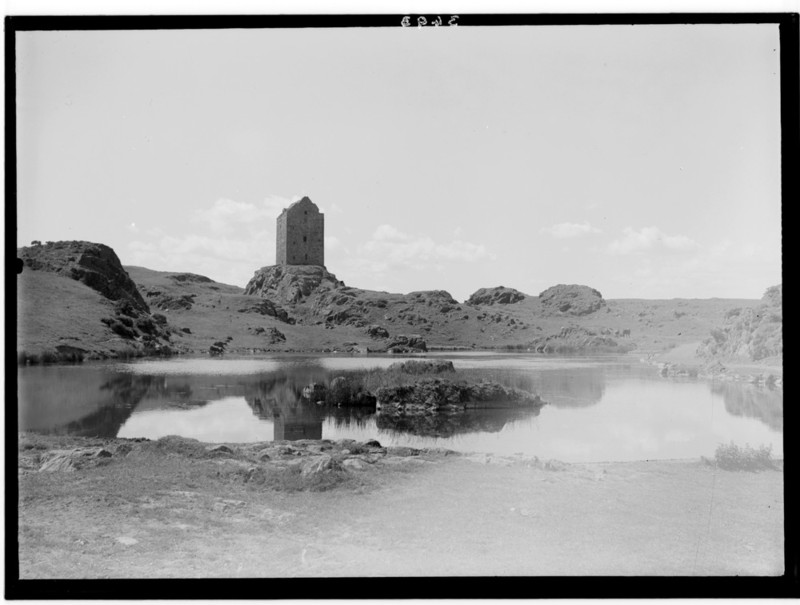
| 10:27, 29 September 2015 | P002488.jpg (file) |  |
73 KB | Smailholm Tower near Smailholm, Roxburgh. Basalt intrusion of Lower Carboniferous age. Crags of basalt forming part of roughly circular volcanic neck intruded into the 'Kelso Traps'. These are basalt lavas of Carboniferous age thought to be contemporar... | 1 |
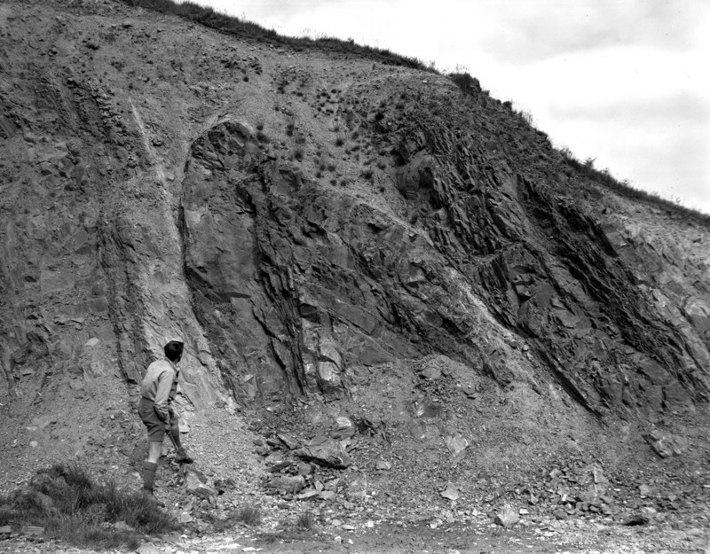
| 09:33, 6 October 2015 | P218281.jpg (file) |  |
185 KB | Peden's View Quarry, 2.6 km. NW of Langholm. Tight fold in massive and flaggy greywackes. P218281 | 1 |
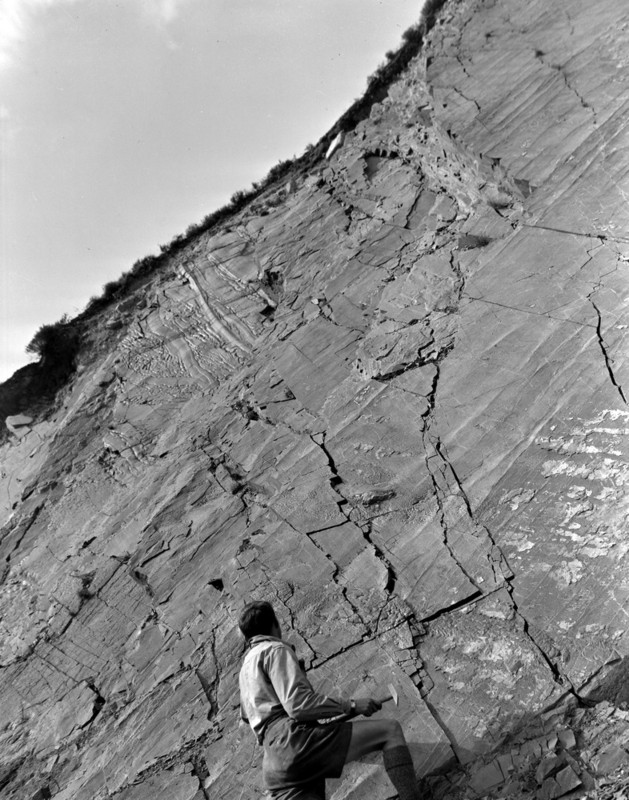
| 09:39, 6 October 2015 | P218294.jpg (file) |  |
159 KB | Pedens View Quarry, 2.6 km. NW of Langholm. Groove casts, bifurcating and groove in groove structure. | 1 |
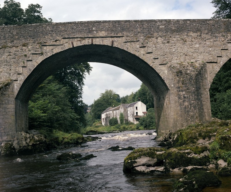
| 09:47, 6 October 2015 | P220173.jpg (file) |  |
195 KB | River Esk, Skipper's Bridge, Langholm. Birrenswark Lavas, forming the foundations for Skipper's Bridge, Langholm. P220173 | 1 |
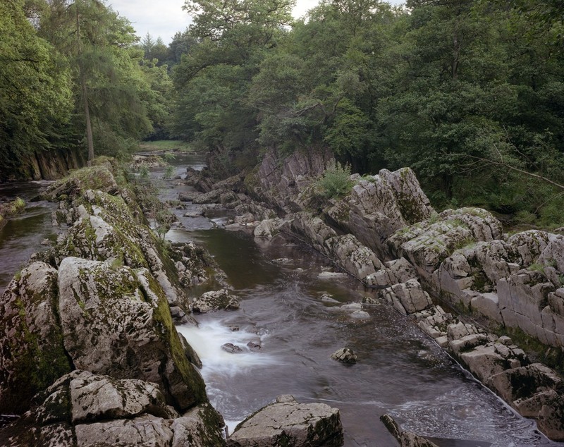
| 09:58, 6 October 2015 | P220174.jpg (file) |  |
202 KB | Penton Linns, Liddell Water, 2.5 m. ENE of Canonbie. Steeply-dipping limestones (Upper Liddlesdale Group). P220174 | 1 |
| 11:55, 6 October 2015 | P266685.jpg (file) |  |
123 KB | Leadhills, Lanarkshire. Manner' Scar, Susanna Vein. P266685 | 1 |
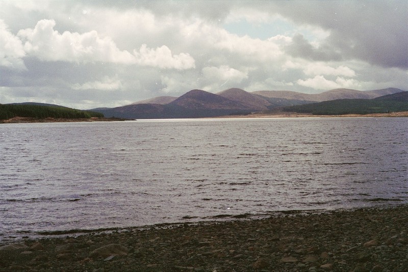
| 12:22, 6 October 2015 | P509338.jpg (file) |  |
120 KB | Loch Doon, Ayrshire/Kirkcudbrightshire border. Looking south-south-east from dam. Black Craig in centre with Coran of Portmark, then Boe, then Meaul, and then Carlins Cairn to the right. P509338 | 1 |
| 12:41, 6 October 2015 | P527792.jpg (file) |  |
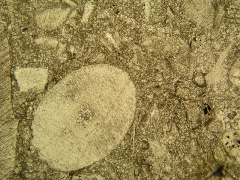
178 KB | Limestone from Bent's Quarry, Macbiehill, Peeblesshire. A medium-grained limestone containing a few what are though to be crinoids weathering to pale brown from Bent's Quarry, 700 yards south of Macbiehill, Peeblesshire. Macbiehill Quarry is in close p... | 1 |
| 12:51, 6 October 2015 | P248524.jpg (file) |  |
186 KB | Talnotry, NE of Newton Stewart. Junction of Cairnsmore-of-Fleet granite with overlying Silurian grit. P248524 | 1 |
| 12:56, 6 October 2015 | P008445.jpg (file) |  |
221 KB | Wood of Dervaird, 2 km. E. of Glenluce. Sinistral fold pair in cleaved and veined siltstone. View down hinges of steeply-plunging sinistral fold pair which deforms cleavage and fine veins and knots of quartz in a fault zone. P008445 | 1 |
| 13:01, 6 October 2015 | P008450.jpg (file) |  |
277 KB | Murray's Monument, A712 Newton Stewart to New Galloway Road. Foliated meta-greywacke. Steeply plunging dextral kink band in foliated meta-greywacke with fine quartz veins parallel to fabric. Cairnsmore of Fleet granite aureole. P008450 | 1 |
| 13:10, 6 October 2015 | P509358.jpg (file) |  |
201 KB | Well-developed rodding in greywacke associated with the Moniaive Shear Zone, Dalry from Corriedoo Forest Road. P509358 | 1 |
| 13:31, 6 October 2015 | P008516.jpg (file) |  |
194 KB | Killantringan Bay. Synclinal fold hinge in greywackes of the Portpatrick Formation, Ordovician. P008516 | 1 |
| 13:40, 6 October 2015 | P008429.jpg (file) |  |
180 KB | Portpatrick Quarry. Monocline in greywackes. The attitude of the Portpatrick Formation greywackes changes from sub-horizontal at the top of the cliff to vertical at the base. P008429 | 1 |
| 09:58, 13 October 2015 | P552675.jpg (file) |  |
206 KB | North Greens (No. 2) Limestone. Bents Quarry, 600 yards north of Macbiehill House. Peebles. Fawn-grey, compact limestone composed of fragments of crinoids, shells and polyzoa in a turbid base partly of granular calcareous debris, partly pelitomorphic c... | 1 |
| 10:14, 13 October 2015 | P008482.jpg (file) |  |
207 KB | Ardwell Bay, N. side. Anticline in greywackes of the Garheugh Formation, Silurian. Fold hinge plunges gently south-west. P008482 | 1 |
| 10:22, 13 October 2015 | P008490.jpg (file) |  |
191 KB | S. side of The Hoolies, Ardwell Bay. Steeply-plunging fold in thin-bedded greywackes of the Garheugh Formation, Silurian. P008490 | 1 |
| 10:31, 13 October 2015 | P008467.jpg (file) |  |
178 KB | Port Logan, sea cliffs on S. side of bay. Tertiary dolerite dyke. Cuts orthogonally across thin greywacke beds of the Lower Silurian Port Logan Formation. Greywackes are vertical, strike 060 degrees south-east. Dyke trends north-west to south-east. P00... | 1 |
| 10:43, 13 October 2015 | P521155.jpg (file) |  |
192 KB | A fossil specimen of Monograptus limatulus. A fossil graptolite. (Graptolithina.) Clanyard Bay, south side, Wigtownshire, Scotland. This specimen of Monograptus limatulus is from the convolutus Biozone of the Silurian and was found on the south side of... | 1 |
| 10:50, 13 October 2015 | P008512.jpg (file) |  |
193 KB | West Tarbet, Mull of Galloway. Steeply-plunging minor folds in greywackes of the Hawick Group, Silurian. P008512 | 1 |
| 10:15, 20 October 2015 | P000823.jpg (file) |  |
184 KB | Siccar Point, eastward view. Berwickshire. Unconformity between Upper Old Red Sandstone and the underlying Silurian (Llandovery) age rocks. Dark red sandstones and breccias of the Upper Old Red Sandstone age dip at low angles to the north and rest unco... | 1 |