File:DalradianExcursion017.jpg
Jump to navigation
Jump to search
Size of this preview: 800 × 242 pixels. Other resolution: 1,400 × 424 pixels.
Original file (1,400 × 424 pixels, file size: 118 KB, MIME type: image/jpeg)
Summary
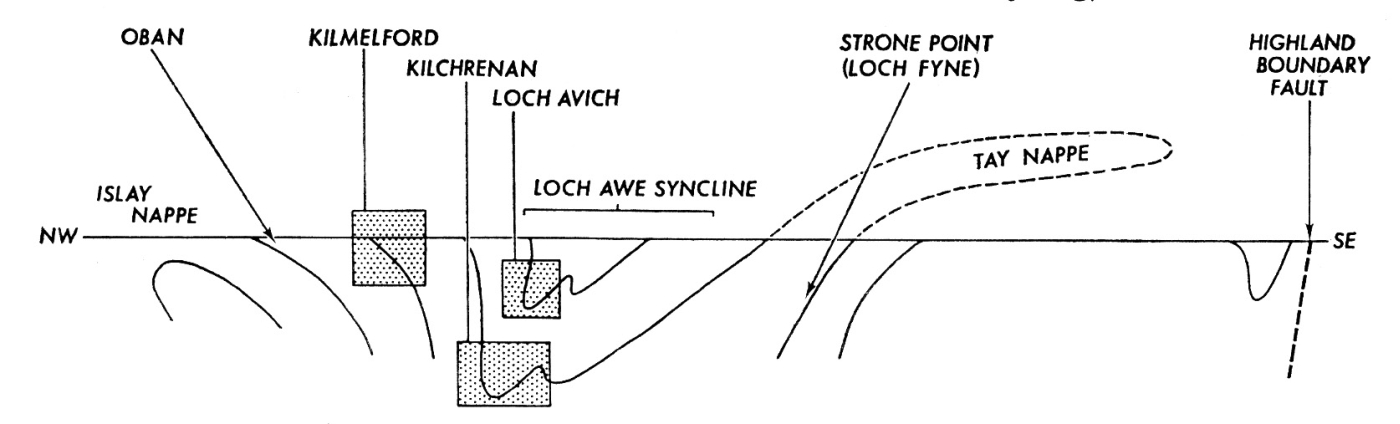
| description | English: Diagrammatic cross-section of the major structures of the IItay Nappe Complex on which are indicated the approximate structural positions of the localities described in this guide. The stippled regions in this cross-section correspond to the areas illustrated by geological maps (Kilmelford), 4 (Kilchrenan) and 5 (Loch Avich). The localities at Oban and Strone Point are, respectively, localities 11 and 12. From: Borradaile, G.J. 1977. 6: The Dalradian rocks of the northern Loch Awe district. Scottish Journal of Geology v 13. p155-164. |
| source | Dalradian rocks of the South-west Highlands. Scottish Journal of Geology 13 (2) 1977 |
| author | Edinburgh Geological Society |
Licensing
{{subst:Custom license marker added by UW}}
| This image is Copyright Edinburgh Geological Society. The images may be reproduced free of charge for any non-commercial use in any format or medium provided they are reproduced accurately and not used in a misleading or derogatory context. Where any images on this site are being republished or copied to others, the source of the material must be identified and the copyright status acknowledged. For all other uses of the images please contact the Edinburgh Geological Society. publications@edinburghgeolsoc.org |
File history
Click on a date/time to view the file as it appeared at that time.
| Date/Time | Thumbnail | Dimensions | User | Comment | |
|---|---|---|---|---|---|
| current | 21:49, 6 May 2015 | 1,400 × 424 (118 KB) | Scotfot (talk | contribs) | User created page with UploadWizard |
You cannot overwrite this file.
File usage
The following page uses this file: